Satellite Eyes on the Sea: Tracking Illegal Fishing and Climate Change from Space
A recent study in One Earth journal found 2,482 high seas fishing boats linked to 1,120 companies. This shows how space tech is changing how we watch the seas.
Now, satellites can see across huge parts of the ocean. They track ships, watch the weather, and study sea life with great detail. NOAA uses this info to check ocean temperatures, currents, and tiny sea creatures. They also track storms and dangers at sea.
Using space tech and marine protection is a big step forward. It helps fight illegal fishing. Goal 14.4 of the SDGs wanted to stop overfishing and illegal sea activities by 2020. Now, we can track ships better to protect our oceans.
This new tech helps protect sea life and supports green practices all over the world.
Key Takeaways
- Satellite tech found over 2,400 fishing boats in international waters through detailed images.
- Space-based systems watch ships and sea activities in real-time.
- NOAA uses satellite data to track ocean conditions, weather, and sea health.
- Modern space tech helps worldwide efforts against illegal sea activities.
- Advanced space tech brings new clarity to ocean monitoring and fishery management.
- Satellite watching is key for reaching marine conservation goals.
Understanding Illegal Fishing: An Overview
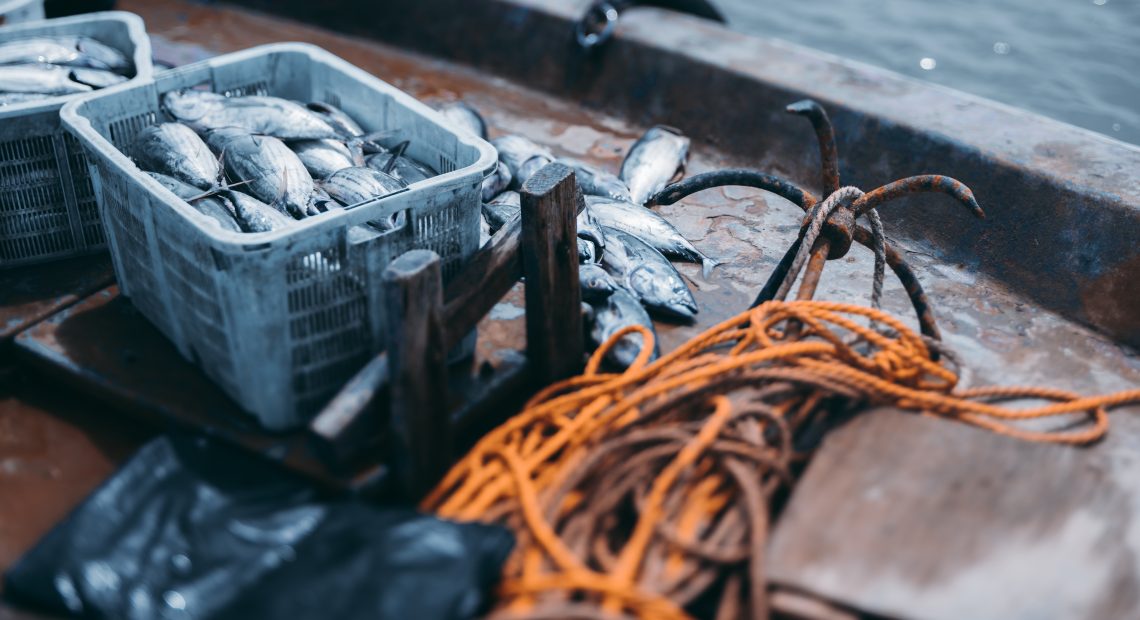
The maritime industry faces a big challenge from fishing that breaks the law. These actions harm marine life and hurt honest fishing efforts. It’s key to understand these issues to find good solutions.
IUU fishing is driven by the desire for quick money and the growing need for fish. It’s a huge industry now. The lack of fish in old spots pushes people to break the rules. This cycle harms our oceans.
What Constitutes Illegal Fishing?
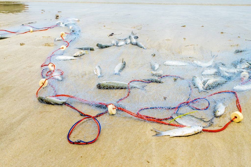
Illegal fishing means fishing without a licence, using harmful methods, and fishing in protected areas. These actions break laws at home and abroad.
Unreported fishing is another big problem. Fishers lie about how much they catch. This messes up data needed for fair fishing.
Unregulated fishing happens where there’s no one watching. It targets species not covered by rules. Without checks, these bad practices keep going.
Impact on Marine Ecosystems
Overfishing and bad fishing methods are a big problem. More than a third of migratory fish are at risk of dying out. This is a big warning sign.
Fishing in the open sea is very bad for the sea. It’s bad for the environment and not good for business. The damage is much worse than any quick gain.
Unsustainable fishing practices lead to fish populations crashing. When fishing is too much, fish can disappear in just a few decades. This hurts the whole sea.
The Global Scale of the Problem
Illegal fishing hurts the economy too. It messes up fish markets and makes it hard for honest fishers. Coastal towns that rely on fishing struggle when there’s less fish.
Food security is at risk because of illegal fishing. Many poor countries depend on fish for food. Losing this resource hurts millions.
We think illegal fishing costs the world billions every year. It affects catches, costs to fix the sea, and the cost of catching the culprits. This shows why we need new tech to fight this.
The Role of Satellite Technology in Monitoring
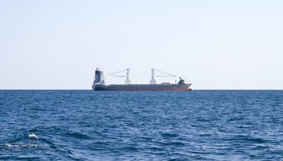
Advanced satellite networks have changed ocean monitoring. They give maritime authorities unprecedented visibility over vast oceans. This technology watches fishing activities worldwide in real-time.
Satellites have big advantages over old methods. They gather data over huge areas quickly. What ships take years to do, satellites do in months.
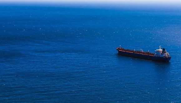
How Satellites Track Fishing Activities
Modern satellites use three main technologies to track vessels. Each technology helps create a strong maritime surveillance network. Together, they track vessels accurately.
Vessel Monitoring Systems (VMS) send location and course data every two hours. It tracks registered fishing vessels. VMS helps check if vessels follow fishing rules and stay within areas.
The Automatic Identification System (AIS) gives real-time tracking for safety. AIS shares vessel details, position, course, and speed always. It’s key for spotting illegal fishing and keeping vessels accountable.
The Suomi National Polar-orbiting Partnership (SNPP) satellite has advanced VIIRS imaging. It captures images in low light, showing fishing at night. It spots vessels trying to hide.
All systems use Unique Vessel Identifiers (UVI) for tracking. These IDs track vessels through name changes or flag changes. UVI stops vessels from hiding by changing their identity.
Advances in Satellite Surveillance
New tech has made satellite monitoring better. Systems now handle lots of data fast and accurately. This lets authorities act fast on suspicious sea activities.
The One Earth study shows satellite power. It tracked 3,584 unique fishing vessels in 2018. The study found owners for about 90% of them.
NOAA uses satellite tech for detailed data. It watches fishing, vessel movements, and the environment. This gives a full view of sea operations and health.
Satellite surveillance has changed how we see global fishing. It brings transparency where there was none.
Satellite networks help fight illegal fishing in many ways:
- Global coverage – Watching remote oceans
- Real-time data – Quick alerts for suspicious vessels
- Cost efficiency – Cheaper than using ships
- Weather independence – Keeps monitoring in all weather
- Evidence collection – Digital proof for legal actions
This tech is a big change in sea enforcement. Satellite monitoring is key for managing fisheries and protecting oceans worldwide.
Climate Change and Its Link to Illegal Fishing
Climate change is changing fishing patterns and creating new chances for illegal fishing. Satellite technology now provides unprecedented insights into how rising ocean temperatures affect marine ecosystems and fishing behaviours. These thermal changes, detected through advanced infrared sensors, show the link between environmental degradation and illegal fishing activities.
Climate-induced changes make fishing fleets explore new territories. As traditional fishing grounds become less productive, vessels go into protected areas or foreign waters without permission. This shift is a big challenge for maritime enforcement agencies and marine conservation organisations.
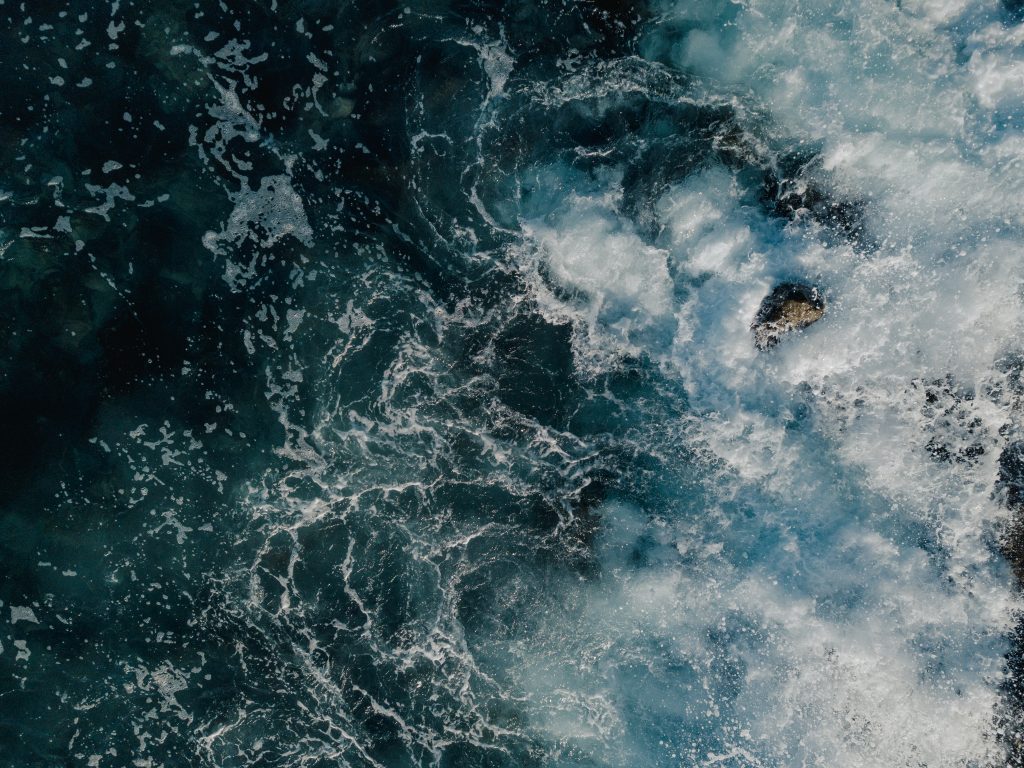
The Effects of Ocean Warming
Satellites with thermal infrared sensors detect ocean temperature changes. These measurements show alarming ocean warming patterns that affect marine life distribution and behaviour. Rising sea temperatures create cascading effects throughout marine ecosystems, changing where fish populations thrive.
Ocean warming causes coral bleaching, destroying marine habitats. When coral reefs deteriorate, fish populations move to cooler waters or deeper areas. This displacement forces commercial fishing operations to fish in protected marine reserves without permission.
Satellite data shows ocean temperatures are rising unevenly across different regions. Some areas experience more dramatic warming than others, creating temperature gradients that influence fish movement patterns. These thermal variations help predict where illegal fishing activities are most likely to occur, enabling proactive marine conservation strategies.
Changes in Fish Migration Patterns
Climate change changes traditional fish migration routes that have remained stable for centuries. Satellite monitoring reveals how species like tuna, salmon, and cod now follow different pathways seeking optimal water temperatures. These shifts create enforcement challenges as fishing fleets pursue valuable catches into unfamiliar territories.
Sea turtles show sensitive responses to temperature changes. These marine animals prefer narrow temperature bands during migration, typically within 2-3 degrees Celsius. When ocean warming disrupts these thermal corridors, turtle populations relocate, and fishing vessels often follow, sometimes entering protected areas illegally.
Temperature-driven migration changes occur relatively quickly, sometimes within seasonal timeframes. This rapid adaptation challenges existing fisheries management systems designed around historical migration patterns. Marine conservation efforts must now account for these dynamic shifts when establishing protected zones and enforcement priorities.
Satellite thermal imaging enables fisheries managers to predict migration pattern changes before they fully develop. By analysing temperature trends and historical fish behaviour data, we can anticipate where illegal fishing pressure will likely increase. This predictive capability represents a significant advancement in proactive marine conservation strategies.
Case Studies: Success Stories with Satellite Monitoring
Satellite monitoring has shown great success in protecting marine life and supporting fishing. These efforts use new fishery management strategies. They show how data can lead to real conservation results.
Using satellite tech in marine conservation has shown its power. These stories are examples for the world. They show how monitoring can help protect wildlife and support fishing.
Using Satellite Data in Brazil
Brazil’s sea turtle conservation is a big win for fishery management tech. Scientists used satellite tags on sea turtles to track their journeys.
They matched turtle data with sea temperature from satellites. This showed turtles like specific temperatures during their travels.
Then, they made tools to predict turtle paths. Fishermen now get info on where turtles are, helping them avoid catching them.
This system has cut turtle bycatch by over 60% without hurting fishing.
This shows how fishery management can save endangered species and keep fishing going. It’s a model for other places in Latin America.
The Mediterranean Sea Initiatives
The Mediterranean Sea was in big trouble, with fish stocks very low. In 2015 and 2017, it had the lowest sustainable fish stocks in the world.
Satellite programs helped by watching the sea closely. They found illegal fishing spots and helped catch the culprits.
They track boats, fishing, and follow rules. This new way of managing fishing has changed the region.
- Real-time tracking stops illegal fishing in protected areas
- Alerts quickly tell authorities of suspicious fishing
- Looking at past data helps spot illegal fishing patterns
- Working together with other countries makes enforcement better
Thanks to these efforts, fish stocks are getting better. Some fishing areas are even starting to recover.
These stories show how satellite tech can change marine conservation. They show that new fishery management can protect the environment and help local economies.
Key Organisations Fighting Illegal Fishing
International bodies work together to fight wildlife crime in fishing worldwide. They use policy, technology, and enforcement to keep the seas safe. Their teamwork shows how we can tackle big ocean challenges together.
Illegal fishing is a big problem that needs many hands to solve. Groups around the world help share information, make rules, and support law enforcement. This helps keep the oceans safe for all.
The Role of the United Nations
The United Nations is at the forefront of fighting wildlife crime at sea. They have set up the Food and Agriculture Organisation’s Code of Conduct for Responsible Fisheries. This code helps fishing be more sustainable everywhere.
But, the code has its limits, mainly because of weak enforcement in the high seas. Without strong rules, it’s hard to stop illegal fishing in open waters.
The Agreement on Port State Measures (PSMA) is a stronger tool. It stops illegal fish from being sold in markets by controlling ports. By 2021, 68 countries had signed up, making a big network of safe ports.
“The PSMA serves as the first binding international agreement on illegal fishing through port state measures.”
The UN’s Global Record started in 2016. It keeps a detailed list of fishing vessels. This helps track where and how they fish, giving law enforcement the tools they need.
Ocean Conservancy’s Efforts
Ocean Conservancy works with the UN to fight illegal fishing. They use new technology and advocacy to help. Their tools help catch and stop illegal fishing.
They focus on using satellite data and artificial intelligence. These tools spot suspicious boats and track fishing patterns. They also train law enforcement to do their job better.
Ocean Conservancy also works to improve laws and enforcement. They partner with tech companies to make better surveillance tools. Their community programs help locals monitor and report on fishing.
These local efforts help enforcement agencies do their job. It shows how important community involvement is for ocean protection.
Legal Frameworks Addressing Illegal Fishing
The fight against illegal fishing is a global effort. It relies on international laws and national rules. These laws aim to stop the illegal seafood trade and promote sustainable fishing. People in the maritime industry must follow these rules to help protect the oceans.
Working together is key to tackling fishing crimes that affect many countries. It’s hard to make all legal systems work together. But it’s vital to keep the oceans safe.
International Agreements and Treaties
The United Nations Convention on the Law of the Sea (UNCLOS) is a key treaty. It lets all countries fish in the open sea. But, it’s hard to enforce laws in such a big area.
UNCLOS also sets up exclusive economic zones (EEZs) for coastal countries. These zones are up to 200 nautical miles from the coast. This gives countries control over their sea resources.
The Agreement on Port State Measures (PSMA) is a big step against the illegal seafood trade. It started on 5 June 2016 with 68 countries joining. The PSMA helps stop illegal fish from getting to markets.
Key parts of the PSMA include:
- Mandatory vessel inspections at designated ports
- Information sharing between participating nations
- Standardised documentation requirements for fishing vessels
- Denial of port services to vessels involved in illegal activities
Even though the PSMA is important, it’s hard to put into practice. By 2020, only 66 countries fully followed the PSMA. But, 75% of members only partly followed it, leaving room for the illegal seafood trade to find ways around.
National Laws Supporting Conservation
National laws are vital to make international agreements work. Countries have laws that manage and protect their fisheries.
Good national laws include:
- Licensing requirements for commercial fishing operations
- Catch limits based on scientific assessments
- Vessel monitoring system mandates
- Penalties for violations including fines and vessel seizures
- Import restrictions on illegally caught seafood
The European Union’s IUU Fishing Regulation is a good example. It requires catch certificates for all marine fisheries imports. This makes it easier to track where seafood comes from.
Satellite technology helps enforce laws by providing proof. Countries use it to check where fishing vessels are. This helps them catch and punish those breaking the law.
Legal frameworks work best when they are consistently applied and enforced by all countries.
It’s important to have a unified way of enforcing laws. Using satellite monitoring with legal systems is a strong way to fight the illegal seafood trade. It helps protect our oceans for the future.
Challenges in Enforcement Against Illegal Fishing
The fight against illegal fishing at sea is tough. It faces many hurdles like technical issues, not enough resources, and gaps in laws. These problems let illegal fishing groups find ways to avoid being caught.
It’s hard for law enforcement to stop illegal fishing ships. The demand for seafood is high, and fishing spots near land are running out. This pushes more boats to the open sea, where it’s harder to keep an eye on them.
Limited Resources for Maritime Patrol
Law agencies have to watch over huge areas of the ocean. But they don’t have enough ships or planes to do it well. The size of the ocean makes it hard to watch over it all with the money they have.
Key resource limitations include:
- Not enough ships to cover all the sea
- Too few planes for watching from above
- It takes a long time to get to fishing spots far away
- It costs a lot to keep ships at sea for a long time
- Not enough training for new tech
It’s hard to keep an eye on the open sea. Illegal fishing groups know this and plan their activities when there are no ships around.
It can take days or weeks to respond to illegal fishing. By the time authorities get there, the ships have already left. This makes it hard to stop them.
Legal Loopholes and Regulations
Current systems to track ships have weaknesses. VMS systems don’t send updates in real time. They rely on ships to send their location, which can be turned off.
AIS systems also have problems. They don’t work for all types of ships. This means some boats can’t be tracked at all.
Regulatory inconsistencies create enforcement challenges:
- Flags of convenience let ships avoid strict rules
- It’s hard to know who is in charge in international waters
- Penalties vary from place to place
- It’s hard for agencies to work together
There’s not enough law in international waters. This makes it a good place for illegal fishing. The laws we have now can’t keep up with the tricks used by poachers.
Going to court against illegal fishermen is hard. It needs a lot of paperwork and help from different countries. This makes the process slow and often leads to small fines.
The Economic Impact of Illegal Fishing
Illegal fishing activities harm the environment but are not profitable. A study in Science Advances shows that fishing in the open sea damages marine life and loses money. This shows how harmful practices can keep going despite not making sense financially.
The fishing industry is in trouble. Up to 30% of catches are from illegal fishing in some key fisheries. This unfair competition hurts honest businesses and depletes resources. The costs include enforcement, market instability, and threats to long-term sustainability.
IUU fishing is a big threat to sustainable fishing, causing billions of pounds in losses every year worldwide.
Losses to Local Economies
Local fishing communities suffer a lot from illegal fishing. Legal fishers get less because illegal boats take too much. This makes it hard for honest fishers to make money.
The effects spread to coastal economies. Processing plants, suppliers, and support services lose out when fish numbers drop. Small-scale fishers, who can’t compete with big illegal boats, lose their fishing spots.
Jobs become scarce as overfishing makes sustainable fishing hard. Communities that relied on the sea for years face economic uncertainty. This leads to more poverty and people moving away.
The Cost of Overfishing
Fish stocks have plummeted, with 67% decline in 2015 and 65.8% in 2017. This is not just environmental damage but also a $260 billion industry collapse. Overfishing has long-term economic costs that outweigh short-term gains from illegal fishing.
Overfishing also means exploited workers and human rights abuses on illegal boats. These unfair practices make it hard for honest businesses to compete. They also harm communities.
Overfishing messes up market prices. As fish numbers go down, prices go up, and there’s less to buy. This hurts everyone from fishers to restaurant owners.
Stopping overfishing costs a lot. Governments spend a lot on catching and punishing illegal fishing. This adds to the financial burden on honest businesses.
To save fisheries, we need better monitoring and international help. Sustainable fishing is the only way to protect marine life and support coastal communities.
Engaging Local Communities in Conservation
Community engagement makes marine conservation real on the ground. Coastal communities know their waters best. They are key in protecting marine life.
Their daily activities on the water offer insights that satellites can’t. This is because they live and work by the sea.
Ocean colour satellites spot tiny life in coastal waters. They give communities data to back up their local knowledge. This helps fishers understand changes in the ocean’s health.
Future satellites will give even more detailed info. This will help us understand our coasts better.
Community-Driven Monitoring Initiatives
Local fishing communities are the first to spot illegal activities. They report strange vessels and fishing methods. Traditional ecological knowledge and modern tech make strong monitoring teams.
Smartphone apps let people report illegal fishing fast. These reports link up with satellite systems. This gives a full picture of what’s happening in the sea.
Training helps locals spot and report illegal fishing. This cuts down on costs and boosts detection rates. It’s very effective in places where official patrols are rare.
Success Through Local Partnerships
Good partnerships mix community effort with tech support. Local fishing groups use satellite data for sustainable fishing. This protects the sea and their way of life.
Training helps communities understand satellite data. Local leaders push for sustainable fishing. They also get rewards for keeping the sea healthy.
Success in partnerships comes from respect and shared goals. Communities get scientific data and support. Conservation groups get local knowledge and ongoing monitoring.
Innovations in Technology to Combat Illegal Fishing
The maritime industry is on the brink of a technological revolution. New technologies are changing the fight against IUU fishing. These innovations are improving surveillance, making it more precise and real-time.
The next generation of GEO-XO satellites is a big step forward in environmental monitoring. They come with advanced sensors for air and water quality. This helps manage fisheries better.
The Ocean-colour sensor (OCX) on these satellites offers detailed marine environment monitoring. It does this from geostationary orbit, giving us accurate data continuously.
Today’s satellite imaging is incredibly precise. It can spot individual whales from space. This shows how it can catch even small-scale illegal fishing.
Drones and Unmanned Aerial Vehicles
Unmanned aerial vehicles are changing coastal surveillance. They fill gaps in satellite coverage. These platforms provide real-time monitoring of coastal waters where IUU fishing is common.
Drones can respond quickly, something traditional methods can’t. Maritime authorities use them to check on suspicious vessels and gather evidence.
Drones have advanced sensors for detailed data collection. They capture high-resolution images and track vessel movements. This is cheaper than using patrol vessels.
AI and Machine Learning in Data Analysis
Artificial intelligence and machine learning are changing data analysis. They build predictive models to find marine species and IUU fishing hotspots. This helps authorities plan better.
Machine learning spots suspicious vessel behaviour. It looks at movement, fishing patterns, and environment. This flags illegal activities for investigation.
AI systems handle huge amounts of data quickly. This lets enforcement agencies act fast and use resources wisely across the ocean.
These technologies give the maritime industry powerful tools for the future. Together, they create a strong surveillance network. This makes it hard for illegal fishing to hide.
The Future of Global Fisheries Management
Fishery management is at a turning point. New technology and policies are changing how we protect oceans and fish sustainably for the future.
Marine management is moving beyond old ways. Satellites, AI, and data analysis are opening up new ways to care for our oceans.
Integrating Technology and Policy
Today’s fishery management needs advanced tools to handle complex ocean issues. Old methods often miss the big picture of marine life.
New methods are being developed to set catch limits better. These consider the whole ecosystem, not just one species.
The EcoCast tool from Southwest Fisheries Science Center is a great example. It uses the environment to find marine animals accurately.
Technology’s benefits include:
- Mapping where species are in real-time
- Less bycatch thanks to predictive models
- Targeting the right fish species
- Quick responses to ocean changes
Working together globally is key to stopping illegal fishing. Technology helps, but laws and enforcement are also vital.
Building Sustainable Fisheries
Creating sustainable fisheries means managing them in a way that adapts to the ocean’s changes. Climate change is changing where fish go and where they live.
The future of fishery management will use:
- Satellites to watch the ocean
- AI to spot patterns
- Global databases
- Reports from local communities
The sea industry needs to adopt these technologies to keep the ocean productive. It’s important to match tech with strong laws and enforcement.
Good policies will help manage fisheries in a flexible way. They can change rules based on new data and how much fishing is happening.
Our oceans’ future depends on using the latest tech and strong conservation policies together.
It’s also important to involve local fishing communities in conservation. Technology should help, not replace, their knowledge and ways of managing the sea.
This mix of technology, AI, and policies offers a chance for ocean conservation and fishing to thrive together. It’s a new era for the sea and its people.
Final Thoughts: A Call to Action
The fight against illegal fishing needs everyone’s help. Satellite tech gives us a clear view of the sea. But, we must all work together to win this fight.
How Individuals Can Contribute
Maritime workers can make a big difference. Support groups that use satellite monitoring. Push for tougher laws in your circle.
Choose products from legal fishing sources. Tell authorities about any odd boat sightings. Your actions count a lot.
What you buy matters too. Pick seafood from places that follow the rules. Teach others about the harm of bad fishing. Join groups that want better fishing ways.
The Importance of Global Cooperation
Working together worldwide is key to saving our oceans. Countries must enforce laws better and share data. Fishing groups need to work better together.
Companies should make monitoring tools available to all. New tech and good policies can really help. This way, fish can thrive again in our seas.
The time for change is now. With great tech and a duty to protect the sea, we can make a difference. Let’s work together for a healthy ocean for all.
FAQ
How do satellites detect illegal fishing activities in vast ocean territories?
Satellites use three main systems to track fishing vessels. Vessel Monitoring Systems (VMS) send location data every two hours. Automatic Identification Systems (AIS) offer real-time tracking for safety.
Advanced satellites like Suomi can track thousands of vessels at once. Studies have shown they can monitor 3,584 vessels in a year. This shows how satellites can spot illegal fishing and help manage global fisheries.
What exactly constitutes illegal, unreported, and unregulated (IUU) fishing?
IUU fishing includes three main types of violations. Illegal fishing breaks laws, like fishing in banned areas. Unreported fishing hides catches, making it hard to manage stocks.
Unregulated fishing takes advantage of lack of rules, mainly in international waters. These practices harm marine life and distort seafood markets.
How does climate change influence illegal fishing patterns?
Climate change affects fish and their habitats. Satellites show how rising sea temperatures harm coral reefs and change fishing spots. This forces fleets to fish illegally in new areas.
As fish move to cooler waters, illegal fishing follows. Satellites help predict these changes, aiding in better fishing management.
Which international organisations lead the fight against maritime wildlife crime?
The United Nations leads the fight against maritime wildlife crime. It has initiatives like the Food and Agriculture Organisation’s Code of Conduct. The Agreement on Port State Measures also helps prevent illegal fish from entering markets.
The UN’s Global Record initiative started in 2016. It creates detailed databases of fishing vessels. Ocean Conservancy also works to combat illegal fishing with technology and advocacy.
What are the main enforcement challenges in combating maritime poaching?
Enforcement agencies face big challenges like limited resources for patrols. This creates gaps for illegal fishing to thrive, mainly in remote areas. VMS and AIS systems have their own limitations, like lack of real-time data.
Legal loopholes also make enforcement hard. Vessels use flags of convenience and exploit jurisdiction gaps. This requires better technology and international cooperation.
What economic impact does overfishing have on global fisheries?
Overfishing has huge economic costs. It damages local and global markets. IUU fishing can make up to 30% of catches in some fisheries, hurting legitimate operators.
The global fish stock has dropped by 67% in 20 years. This threatens the 0 billion fisheries economy, showing the impact of illegal fishing on markets.
How effective are community-driven marine conservation initiatives?
Community-driven initiatives are very effective. They use traditional knowledge and satellite tech to fight illegal fishing. Ocean colour data helps communities understand marine ecosystems.
These initiatives create effective monitoring networks. They combine community reports with satellite data to spot illegal fishing. This is a cost-effective way to protect marine life and support coastal economies.
What technological innovations are revolutionising fisheries enforcement?
New technologies are changing how we detect IUU fishing. Drones and unmanned aerial vehicles (UAVs) provide real-time monitoring. Next-generation satellites have advanced sensors for air and water quality.
Artificial intelligence and machine learning are also key. They help predict where marine species will be and spot suspicious vessel behaviour. This leads to better enforcement strategies.
What legal frameworks address the illegal seafood trade?
International agreements are key to fighting the illegal seafood trade. The United Nations Convention on the Law of the Sea (UNCLOS) sets rules for fishing in international waters. The Agreement on Port State Measures (PSMA) helps stop illegal fish from entering markets.
But, there are challenges in implementing these agreements. Only 66 countries fully comply with PSMA. This shows the need for better enforcement.
How do satellites support sustainable fisheries management?
Satellites help manage fisheries by monitoring the environment. Tools like EcoCast predict where marine animals will be. This helps fishers target the right species and avoid bycatch.
Satellite data also helps calculate the maximum sustainable yield (MSY) for fish stocks. This requires complex models to consider all fish stocks. Satellites and adaptive management policies work together to manage fisheries sustainably.
What role can maritime industry professionals play in combating illegal fishing?
Maritime professionals can help fight illegal fishing in many ways. They can support satellite monitoring, push for stronger laws, and adopt sustainable practices. Their networks can drive change in global fisheries management.
Working together, nations, industries, and communities can strengthen enforcement. This makes maritime professionals key players in protecting oceans and promoting sustainable practices.
How accurate is satellite technology in detecting individual fishing vessels?
Satellite tech is very accurate. It can count individual whales from space. This shows it can spot even small-scale illegal fishing with great precision.
Modern satellites can gather data across vast oceans quickly. This is much faster than traditional ship-based monitoring. It gives fisheries management and enforcement agencies a powerful tool to fight illegal fishing.
Resources
Illegal Fishing Detection from Space
-
Global Fishing Watch
https://globalfishingwatch.org
Offers open-access satellite-based tools and maps to track commercial fishing activity and combat illegal, unreported, and unregulated (IUU) fishing. -
SkyTruth
https://skytruth.org
Uses satellite imagery and remote sensing to monitor environmental threats including illegal fishing, oil spills, and habitat loss. -
The Ocean Mind Platform
https://oceanmind.org
Supports enforcement against illegal fishing using satellite analytics and AI, partnering with governments and NGOs globally.
Climate Change Monitoring via Satellites
-
NASA Earth Observatory – Oceans
https://earthobservatory.nasa.gov/topic/oceans
Tracks sea surface temperature, sea level rise, ocean color, and more via satellite observations. -
ESA Climate Change Initiative – Ocean
https://climate.esa.int/en/projects/ocean/
Provides long-term datasets from satellites for understanding changes in ocean temperature, salinity, and currents. -
NOAA Ocean Data Viewer
https://data.noaa.gov
Offers access to satellite datasets on ocean temperatures, marine heatwaves, and sea-level anomalies.
Satellite Missions & Data Tools
-
Sentinel Missions (European Space Agency)
https://sentinel.esa.int
Details on Sentinel-1 and Sentinel-3 satellites, which are instrumental in maritime surveillance and climate monitoring. -
Copernicus Marine Environment Monitoring Service (CMEMS)
https://marine.copernicus.eu
Provides satellite-based oceanographic data for marine safety, climate, and ecosystems. -
NASA’s MODIS & VIIRS Sensors
https://modis.gsfc.nasa.gov
Monitor sea surface temperature, ocean color, and phytoplankton blooms from space.